monumental
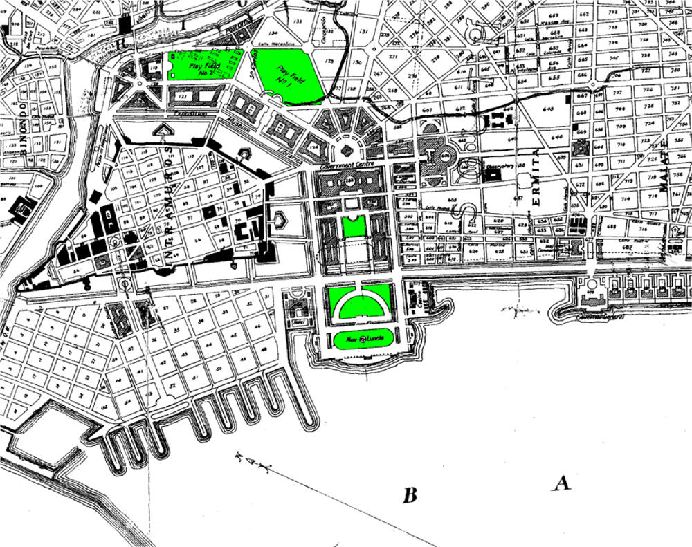
Here's detail from Burnham's plan. (Colors have been altered, of course.)
You can clearly see the the diagonal boulevards and the grid. Also, the present Rizal Park was supposed to be a government center -with monumental buildings arranged in a half-arc facing the bay. The Executive Building (previously occupied by the Senate and now by the National Museum*) and the Finance Building were the only ones that got built. I think the Commonwealth Government set aside money for the project (saved over a decade) but then decided to spend it on rural irrigation projects instead.
The boulevards all terminated at the center of the arc of buildings - one road had a direct connection to the railroad station in Paco.
Notice also how the new government center butted-up right next to the walls of Intramuros -giving it an active edge. Currently, the Walls have open fields/parks/driving ranges as foreground -with no active edge connecting the old city to the new city.
(*isn't it sad that the National Museum doesn't seem to have it's own domain and seems to just be squatting on Tripod?)


2 comments:
This a nice closer look at Manila. Although technically I'm not a Manila resident (I reside in Quezon City) almost everday of the week when I was still studying in De La Salle University Manila I would go by Quezon Avenue and Taft Avenue. Going to school I could see Intramuros on the right, but going through the underpass out Taft Avenue lies the National Museum and Rizal Park. So everyday its like a historical stroll for me.
there are a number of historic buildings along your route. taft avenue has a number of gems. too bad most of them are not kept in good condition.
you should try exploring the areas around DLSU - between taft and SLEX -the Vito Cruz area has a lot of early 1900s late 1800s structures.
Pasay, between Buendia and Vito Cruz, has a lot of old stock -but they are hidden behind high walls.
Post a Comment