Showing posts with label series: rethinking our streets. Show all posts

2.03.2006

green infrastructure
rethinking our streets (3)
updated with numbers


Image credit: A new community redevelopment project in Seattle includes a natural drainage system.
From Stormwater (The Journal for Surface Water Professionals).
The only time we realize that our streets are actually part of a larger-scale ecosystem is during a heavy downpour when storm water decides to use our streets as temporary rivers.

Engineers deal with storm water the same way they deal with any input-output problem. The equation is simple: to cope with the incoming volume, increase the throughput so that you get maximum output. That is the dogma -and that's how we've been dealing with floodwaters on our streets ever since: Move it out as fast as possible to the nearest body of water. Big storms require big drains and a bigger the flood control system. (Some of our widest roads have five meter diameter pipes as stormwater drains.)

(The biggest example of this thinking in Metro Manila is the Manggahan Floodway which channelized portions of a river and then built a long canal to drain the low lying parts of the eastern metropolis into the Laguna Lake.)

The drain-the-waters-as-fast-as-you-can approach, works, to a certain point. It fails if: 1) the input volume is bigger than what you designed the system for; or 2) if the throughput gets clogged.

The throughput does get clogged. Often. Which requires a lot of maintenance, a lot of keeping the channels clean -of building even bigger pipes to drain the water. And every year, we get the same complaint: trash clogs the drainways. At the same time, we've been paving over more and more of our land area causing more water to run off into our streets and overwhelming our flood control systems.

Year after year, the floods get worse (especially the flash floods on EDSA and the Buendia-SLEX intersection) and year after year, the proposed solution is the same: more maintenance, or proposals for bigger flood control projects.

Time for a rethink.

Natural systems approach water differently. Nature prefers to slow down the water, allowing it to pool around tree roots, slowing the flow with grass, collecting it in seasonal ponds and generally letting it percolate into the soil. This has two effects: 1) it reduces surface water runoff so the creeks and waterways don't get overwhelmed and 2) it preserves precious topsoil, keeping it from getting washed away.

Engineers have realized that the environmentalists do have something to say and have made the connection that speeding up water is ineffectual and damaging to the environment. (You can draw a straight line cause and effect from the flood control projects in the Mississippi river basin to the tragedy of New Orleans.)

They have also begun to rethink how to handle water runoff on streets and roadways. Yes, you want to drain the roadway, but it doesn't mean channeling the water out to the nearest body of water. It is better to hold and percolate -not shunt it out but allowing it to recharge the groundwater aquifers. (And yes, our aquifers do need recharging. See this pdf report -2.6mb).

So, landscaping -which was used primarily as ornamentation (and apparently still is) is now seen as an approach to handling water-runoff. Instead of trying to drain the rainwater off into pipes, landscape systems (like shared tree wells, permeable pavements and bioswales) hold the water locally and drain it into the soil rather than draining it into a flood system. The landscape becomes a natural flood control system. (Guess what, it also reduces water pollution -by eliminating nonpoint source pollution and by using the soil to filter the water before it gets to the aquifers.)

So the clean-and-green proponents and the save-the-pasig movement need to sit down with our traffic and the flood control engineers to re-think the way our streets deal with water.

Well designed streets, which reconceptualize the network of roads as green infrastructure -so that it not only carries vehicular traffic but also protects the environment, will do more than just provide us with grassy medians, sidewalk trees or flower beds. Well designed streets will probably save our cities and revive our dying rivers and lakes.


NEW! UPDATED! NOW WITH NUMBERS!

A conversation with a friend led me to running some number scenarios of what the stormwater runoff volume for Metro Manila might look like, and though the math is rudimentary, the numbers are startling:

If you assume that 30% our megacity's land area (636 sq.km.) is devoted to pavement (roadways) and 5% devoted to waterways (very generous assumption), then you would get:
  • 191 sq.km of roads
  • 32 sq. km. of waterways
If a storm dumps water at the volume of 10cm per hour (that's about 4 inches of rain -not so spectacular for the metro), the 191 sq.km of roadways would produce a runoff volume in the order of 190.8M cubic meters. (And we're only looking at the roadway runoff -and naively assuming that nothing else (parking lots, driveways, etc.) drains into the roadways.

Assume, again rather generously, that your 32 sq.km. of waterways has an average depth of 2 meters -then the total carrying capacity of the waterways would be 63.6M cubic meters -or roughly just 1/3 of the runoff our roadway will produce. (And we're assuming that the throughput is at 100% -no trash or blockages.)

That means our waterways will have to drain completely every 20 minutes if it is to absorb and remove just 1 hour of (10cm) of stormwater runoff from our streets!

If only 50% of our streets (paved areas) had some natural drainage/bio retention system -of say 1M depth holding capacity for every square meter of street, we could absorb half of that runoff (95.4M) locally. No need to wait for the waterways to drain.

1.21.2006

measure for measure
rethinking our streets (2)


"The common thread in the new approach to traffic engineering is a recognition that the way you build a road affects far more than the movement of vehicles. It determines how drivers behave on it, whether pedestrians feel safe to walk alongside it, what kinds of businesses and housing spring up along it." WIRED 12.12


If there is one piece of unsolicited advice that I would like BF and the other Metro Manila mayors to hear, it is this:

If you want to improve quality of life in the city,
change the qualitative measure you use
for measuring road performance
.


It has become dogma among traffic engineers to measure road design by Level of Service (LOS). LOS has many factorials in the mix but essentially, on highways, LOS is measured at cars per second per mile highway. So the more cars pass at faster speeds, the higher the level of service. On city roads, the LOS is measured along intersections and is calculated as seconds delay per vehicle. So the longer a car is delayed at an intersection, the lower the LOS of that intersection.

Makes sense, if your main interest is keeping the traffic flowing. You can see that logic in play with the MMDA's u-turn slots. The intention of the closing the intersections is to make the road a clear way -thereby reducing seconds of delay, thereby improving the LOS.

So what's missing from the picture? Again, it goes back to thinking of streets only as roadways. It does not account for:

  1. volume of people moved

  2. road safety

  3. effect on commerce along the street

Why are these important?

Move people not vehicles

Counting vehicles instead of people means the bus that carries 50-75 people is equal in count to one person driving a car. Try comparing how much road space a bus with 75 people takes up, vs. 75 cars each with a driver. If you want to increase road efficiency, then you go to the more important factor of counting how many people you can actually get from one place to another.

Faster roads are less safe and less efficient

Increasing vehicle speeds increases the likelihood of accidents. It also makes the road more dangerous for pedestrians and bikers. Plus, it requires you to separate pedestrian traffic by raising the crosswalk.

It is not speed per se that bothers drivers, it is the unpredictability of traffic flow. Slower speeds but smoother flowing traffic is actually preferable to high speed, variable delays roadways.

Road capacity also suffers at higher speeds -faster traffic takes up more space per car than slower trafic. (Read more about the impact of road diets.)

One approach is to look at average vehicle speed and the standard deviation from the speed - then working on reducing the standard deviation, not increasing the speed. Reducing the deviation means smoothing out the traffic.

Commerce dies next to fast streets

Because fast streets feel less safe for pedestrians, commerce at street level dies. It is no accident (no pun intended) that retail flourishes on the slowest intersection of Quezon Avenue. The rest of the avenue (which was designed as a boulevard and has fabulously wide sidewalks) is devoted to seedy nightlife KTV bars that are dead in the daytime.

I know QC is in excellent fiscal health, but imagine how much more they could earn in sales taxes if Quezon Ave. was an active retail destination?

So, to reiterate: If the mayors to improve the city, they must change the qualitative measure they use for measuring road performance.

There are other, newer ways to measure LOS. The Victoria Transport Institute (Canada) publishes several studies on transportation costs and traffic management. There's an excellent one on traffic access and mobility (pdf).

The MM mayors and BF recently visited Vancouver to study the city's best practices on waste management. I can only hope they had the time to study Vancouver's traffic management plan and see how good street design will serve both vehicles and pedestrians and improve the quality of life in our cities.

(I'll be continuing my series on rethinking our streets -but next up: why the Heritage Conservation Society should be fighting rent control.)

1.18.2006

streets not roads:
rethinking our streets (1)


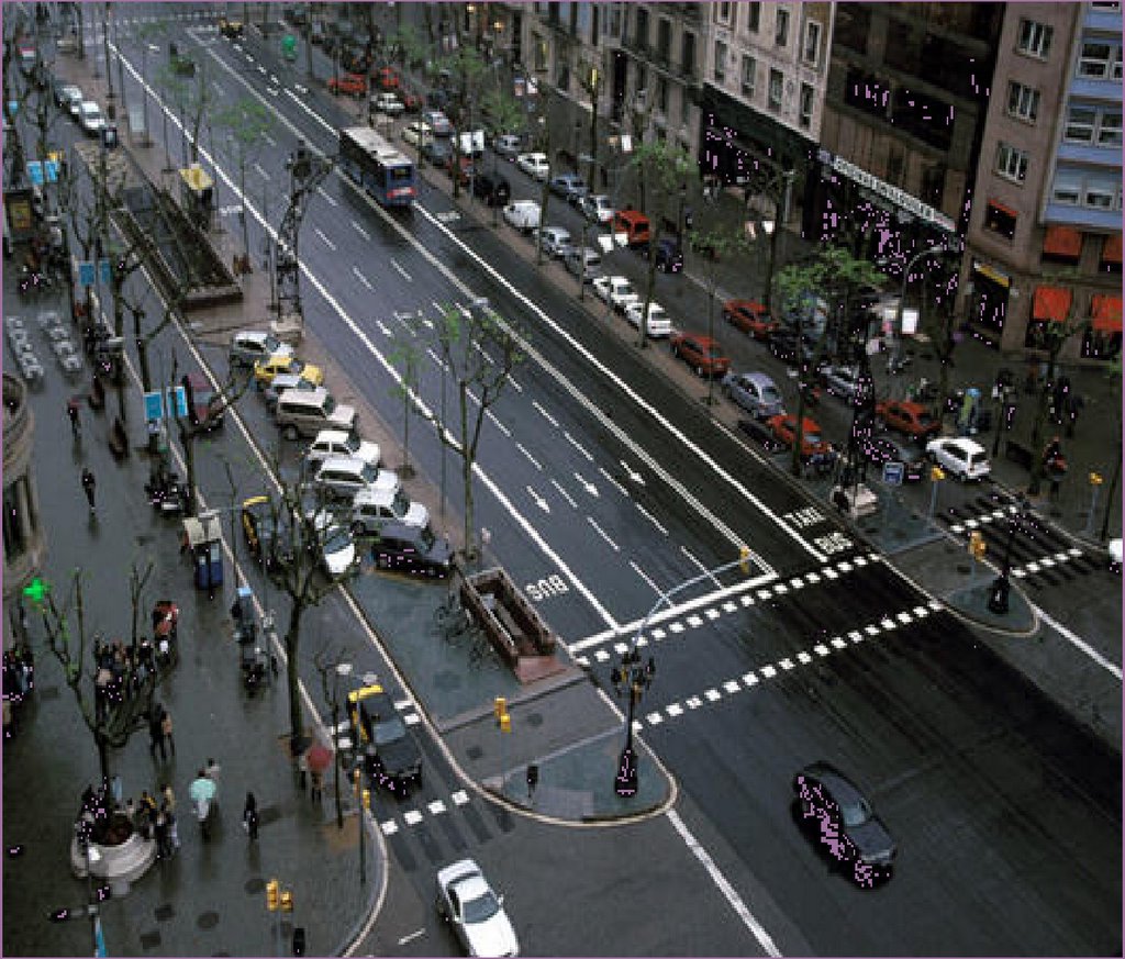
We remember cities mostly by their streets. A high street or a major commerce corridor imparts to us our lasting impressions of a city. So there is Las Ramblas in Barcelona, Picadilly Circus in London, Times Square in New York, Tsim Sha Tsui in Hongkong.

Streets are the largest publicly owned spaces in any city and also take up the majority of land use. Typically 30-35% of a city's land area is devoted to streets.

Streets are the lifeblood of any city and convey commerce and people from home to office to factory. Streets are also the infrastructure web that defines a city -that connects districts and functions and serves as wayfinding. More than buildings or monuments, streets carry what Kevin Lynch calls the image of the city.

Streets, like cities, also persist. Unless interrupted by war or catastrophe or bad urban planning, a city will retain the fabric of its streets through the centuries. Rome has kept its fabric -so has Jericho and Jerusalem -so has Istanbul and Cairo.

Streets that serve cities well serve many functions -and conveying car traffic is just one of them. Streets move people -on foot, on bikes, in cars, in buses. Streets provide public storage for private goods (parking). Streets are exchanges -where people can meet, sell goods, explore the city. Streets are environmental channels - generating pollution or moving rain and stormwater - or providing trees. Streets are free public event spaces for fairs, concerts of mass demonstrations.

Which is why it concerns me that the MMDA, as part of its home city improvement bent, is undertaking a road improvement program. (Starting with Commonwealth Ave. in Quezon City.) -I'm not sure whether it's 7 or 9 (older reports say 9) but here's the gist of what they want to do:

"MMDA's "Seven Major Roads" program, an integrated infrastructure development program focusing government resources in the improvement of seven major transport corridors, namely ; Commonwealth Ave., R10, C5, EDSA, Quezon Ave., and Marcos Highway.

Improvement of these seven major roads includes road widening, geometric improvements, sidewalk rehabilitation and various street furniture."

I'm not complaining about the effort -i'm complaining about the bias for roads vs. streets.

Roads are for cars. Streets are for people (including people in cars).

The logic of Metro Manila's streets has, for far too long, been dominated by auto-chauvinism. Motorized transport -particularly cars, are seen as the primary use of streets. Sidewalks have been sacrificed to the roadway (road widening) and then pedestrians are derided for spilling onto the road. Pedestrians are forced to accomodate cars - by corraling the sidewalk with fences and using overhead crosswalks instead of at-grade crossings.

This is not surprising seeing that the opinion leaders are probably all car owners/users. Also because our public transport system is built on motorized transport (and driven by weird logic of the boundary system).

If we are to recover our metropolis, if we are to make it livable, we must begin by reclaiming the lost functions of our street.

(more on this to follow)

Quick Links

Notable posts on the metro