7.30.2007

links monday 073007


If you've been too busy to read through those very interesting links I've been putting in the Quick Links and Notable Posts on the Metro at the bottom of this page (both list are sourced from my del.icio.us links here, and here) , as well as the links to the Notable articles on top of my sidebar, I've decided to (*fingers crossed*) devote Mondays to a roundup of those links.

The articles are great reads and hopefully add to the lessons we can learn and ideas we can implement in our own metropolis.


Complete Streets

In USA Today, John Ritter reports on "Complete Streets" -the growing movement to design streets to accommodate all modes of transport -pedestrians, bikers, public transit and yes, private cars.
A growing number of states and local governments are rejecting a half-century of transportation practice and demanding that streets accommodate all types of travel, not just automobiles.
Complete streets are "designed and operated to enable safe access for all users. Pedestrians, bicyclists, motorists and bus riders of all ages and abilities are able to safely move along and across a complete street."

I've discussed this topic extensively in my series on Rethinking our Streets.

See also the Complete Streets Coalition (US-based) for more ideas and links.


Paris and Public Transportation

In the New York Times, Serge Schmeman talks about what Paris is doing right:
"...to make it awful to get around by car and awfully easy to get around by public transportation or by bike."
The Mayor of Paris, Bertrand Delanoë, a Socialist, has vowed to reduce car traffic in the city by 40 percent by 2020.

He’s serious about it..two years ago the city laid down a granite divider between the bus-only lane and the cars, squeezing private cars from three lanes to two. Taxis and bicycles may use the bus lane.

At the same time, every bus stop was newly equipped with a screen that told you how long the wait was for the bus. During rush hour, when the cars stand still along Boul’ Mich, there’s nothing better than zooming past them in a bus.

And Delanoë’s latest gambit in the anti-car war is the bicycle. Last week, the city started a program to rent out 10,000 bikes ( a program copied from cities such as Barcelona, Lyon, Lausanne and Geneva).

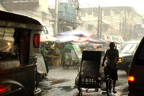
Seems like human powered public transport is the way to go.


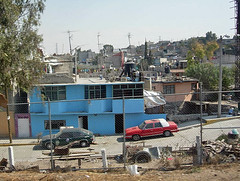
Transforming Mexico City

Meanwhile, NYT also reports that Mexico City Mayor Marcelo Ebrard is "trying to do what some might consider impossible: transform his megalopolis into a place that's more healthy, livable and even fun."

Since taking office in December, Mayor Marcelo Ebrard has imposed tougher traffic rules to make pedestrians safer, installed security cameras in high-crime neighborhoods and required city staffers to ride their bicycles to work once a month.

The city trucked in sand to build ''urban beaches'' at seven public pools, screened outdoor movies and inaugurated ''bicycle Sundays'' when thousands of cyclists, skaters and pedestrians take over the main avenues. Ebrard even invited former Vice President Al Gore to lecture city residents about climate change this week.

...

The mayor's goal is transforming the city into Latin America's latest model of urban renewal. The big idea behind these relatively inexpensive measures is that by encouraging happiness, rather than solely economic growth, he just might change residents' image of their city -- and themselves.

''For us, it's important to continue promoting healthy living, and that means taking back public spaces to create a safe, better city,'' Ebrard explains.


Not sure we can try the "Urban Beaches" (an idea they borrowed from the French) until we get the Pasig to an acceptable level of clean, but I'm certainly all for requiring public officials to take bikes (or public transit) to work.

The big picture though is that this is Mexico City we're talking about! If they can try it, why can't we?


Chinese cities want to speed up urbanization

Lastly, the Economist reports on the race to urbanize China. They highlight the case of Chongqing in western china and its race to make the "vast municipality (the area is as big as Scotland) an oasis of modernity in China's backward west (and its goal:) by 2020 the municipality must be 70% 'urbanised'."
The municipality's official population is more than 30m, which if it were a single city would make it one of the largest in the world. To achieve the 2020 target, country-dwellers must move into urban areas at a rate of more than 500,000 a year.
Chongqing is a "microcosm of China's struggle to move millions from rural to urban areas." For all the travails of the rapid pace of urbanization (pollution, congestion, slums) China is determined to move its vast population into its cities for very rational economic reasons. They seem to understand that the growth of their economy is directly related to the growth of their cities.

A concept that somehow we haven't yet embraced. (Take a look at this gapminder chart of how urbanization is related to per capita income.)


7.28.2007

why are there squatters?


(This entry is meant partly as an answer to Peter Anglionto's comment in a previous post and also as an expansion of the ideas from the last entry. Get a cup of coffee, this is a long one.)

The national government declared the other day that it would spend US$ 1.1 billion to resettle squatters in Metro Manila. The government plans to construct 265,955 housing units with each housing unit costing an estimated $4,200 (about PhP 185,000 per).

That news came right on the heels of the MMDA vowing to eliminate squatters from the Metro within 3 years.

All of this might be part of the posturing for the ASEAN Ministers Meeting next month but they are, nevertheless, the latest in a long, long history of attempts to remove and relocate informal dwellers (most precipitated by impending international conferences) and part of the long history of informal settlers in the metropolis.

So why are there squatters? This is, of course a multi-faceted problem, but the usual quick answers are:
  • because of poverty
  • because of lax law enforcement
The two answers are both partly true but the first only addresses the economic status of the informal dwellers (they can't afford to rent from the formal housing market), while the second only addresses the state's inability to prevent squatting in the first place (it can't protect land).

Although poverty does explain the economic choice of the poor in the city (to find housing in the black market for shelter) you still have to ask, why do the poor choose to be in the city in the first place? Why don't they opt to stay in the rural areas? Why the extreme concentrations in the metropolis? Wouldn't the poor be slightly more comfortable in the countryside where there would at least be land to till for subsistence farming?

As to lack of enforcement, many (like Peter) blame the Lina Law (the Urban Development and Housing Act -R.A. 7279) which decriminalized squatting and imposed requirements for relocation before eviction. The provisions, they say, are onerous (at least to the landlords) and abet squatting.

But we must remember that squatting and squatter colonies existed in the metro prior to the passage of RA 7279. There were squatters back when it was still illegal a crime to be a squatter. At the end of Marcos' first term (1968), as much as a third of the population of the NCR were illegal settlers. Even Marcos, with his full dictatorial powers, could not evict the existing squatter colonies and Imelda had to resort to hiding the slums behind the facade of whitewashed enclosing cement walls whenever she hosted an international event. (A cosmetic approach that apparently hasn't lost its appeal.)

You can argue that our feudal, patronage politics encourages large squatter populations, keeping them as voting bailiwicks. As true as that may be, it still doesn't answer the question of why people opt to move into the city and into squatter colonies rather than, as above, staying in the countryside (where, apparently, fewer people go hungry).

So, why are there squatters? Why do the poor choose to huddle into our urbanized areas? The answer to that question also answers why the metropolis experienced explosive growth (in urbanized area and population) in the last half century.

(I couldn't track down any relevant figures in the 2000 census, but in 1958, more than half of the residents in the NCR were migrants from the rural areas. I would venture that the current percentage would be larger given the metro's average population growth rate of 12% since 1948.)

The answer, I venture, is about the relative economic productivity of each square meter of land in the metropolis. The 639 square kilometers of Metro Manila account for a fifth of the nation's GDP. Each square kilometer in the metropolis produces US$ 158,000 per year while the rest of the country's land (and here, I am assuming all other land is flat and arable) produces $1,720 (barely one percent vs. the metro). Which means, in theory, that living on a square meter of land in the metropolis provides the potential of making an average of more than PhP 7,000 per year, while the equivalent in the countryside offers a measly PhP 77.

Of course, these are all gross numbers and averages but the numbers do point to the relative opportunities provided by Metro Manila vs. the rest of the country.

In network terms, the metropolis is a highly connected (economic) hub in a scale-free network. A condition we have to consider if we are to find effective solutions.

Why are there squatters? Because an individual has better chance of earning a living in the city than in the countryside, even if that means living in makeshift shanties on illegally occupied land.

Which then points us to the problem that has plagued our endless squatter relocation programs -taking people out of squatter colonies and moving them back to the provinces (the "balik-probinsya" programs so popular among our local governments) -will not work because the economic logic (the opportunity to make money) will always trump the logic of moving away from the city, even if you provide a shortcut to land or home ownership.

The national government gave no specifics about how it would effect the PhP 50 billion relocation program, but it did specify that the allocation was for building homes. Given our stubborn track record, it would be no stretch to imagine that this means finding building relocation sites outside of or at the periphery of the city. Which is, to say, it will probably also fail.

The squatter problem is intertwined with the challenge of managing and coping with the rapid growth of the metropolis. Which brings me to Peter's question in his latest comment, who exactly in government is in charge of or is planning for this growth?

Apparently, no one directly. I know of no subcommittee of the cabinet that integrates the key issues that characterize urban growth: land use, transportation, housing and economic development.

Ideally it should be the Housing and Urban Development Coordinating Council* -but they seem to be focused only on making housing affordable and providing affordable housing. There seems to be no coordination with the DPWH, that builds highways, or the DOT that manages transportation, and of course, land use is the purview of local governments who report to the DILG.

So, no one apparently. Which is probably why we got into this mess in the first place.

Oh, one more thing to keep in mind. We are not alone. The images above are of squatter colonies from megacities all over the globe. The UN estimates that there will be 2 billion slum dwellers in the world by the end of the decade. We share the problem, and quite possibly the solutions, with the rest of the world.

For further reading, I highly recommend Robert Neurwith's "Shadow Cities." Neurwith lived for two years in four of the biggest slums in the planet (Rocinha, in Rio, Brazil; Kibera, in Nairobi, Kenya; Sanjay Gandhi Nagar, in Mumbai, India; and Sultanbeyli, in Istanbul, Turkey). He spends the first part of his book reporting on the daily life in these neighborhoods then discusses the issue of squatting from the questions and theories of land ownership.

You can catch excerpts and reviews of Neurwith's book from the Global Business Network, from Boingboing, and from WorldChanging.


*I believe the name puts the cart before the horse. If I had my druthers, that acronym should be UDHCC.


---

P.S. -I'd like to express my appreciation to Peter, Eugene and Fred (my "regulars") who take precious time out of their day to read and react to my kilometric and often dense posts. It makes the time I spend researching and writing these entries all the more worthwhile. Thank you, gentlemen.

7.24.2007

growing metro manila


The animation above shows the rapid growth of highly urbanized areas (areas in yellow) in the National Capital Region from 1948 to 1999, and, as estimated, by 2015.

The growth is nothing short of spectacular.

Starting with just 83 square kilometers in 1945, the metro grew thus:

  • 1948 =83 km2
  • 1966 =221 km2
  • 1975 =323 km2
  • 1996 =788 km2
  • 2015 =1,512 km2 (projected)

    (Click on the year to see a snapshot for that year.)

So, in 48 years -from 1948 to 1996 - the highly urbanized core of the metropolis grew by an astounding 705 square kilometers or 849%. That means the development grew by an average of 14.6 square kilometers every year (18%). That's like adding an area half the size of the city of Makati to the metro every year.

The rapid urban growth, coupled with an equally explosive population growth pretty much explains why we went from the idyllic urban scenes of the 60s to the current chaos of Metro Manila.

Greater Manila's population was about 1.5 million in 1948. It hit 10.8 million by 2000. Which meant we added about 180,000 people to the metropolis each year.

That's like moving the whole (current) population of Cebu City to Metro Manila every 4 years.

No planning department (indeed, no organization) in the world could have coped with that kind of explosive growth.

The pace of growth also explains the housing crunch that we currently face. To cope with that growth, we would have had to build at the pace of nearly a hundred houses everyday for the last fifty years. (No, we couldn't get time off for weekends, either.)

I'll discuss this more on my next post - which will also be my answer to Peter Angliongto's last comment.

We're not done yet! If the projections are correct, the highly urbanized core will nearly double in size by 2015.

This kind of growth though is par for the course of megacities worldwide and is a part of the global trend of rapid urbanization.

It's good to keep this frame in mind next time you get tempted to blame all of Metro Manila's woes on our our supposed lack of discipline, or the avarice of our oligarchs or the corruption of our local officials or even the (presumed) faults of our culture.

Remember, it's not the attitude, it's the (sheer) numbers.


Data for map image extracted from MMUTIS
from a presentation by Dr. Ricardo Sigua

7.22.2007

manila by night


Google Earth has released several new layers, among them NASA sourced content including Earth By Night.

Seeing the human generated lights on the night time hemispheres is not only beautiful, but they also reveal the urbanization patterns across the landscape. (They also show how much light pollution we generate.) The screencap above shows how the megamanila urbanized region stretches from Clark in the North to Batangas City in the South along very strong corridors. It also shows the Metro Manila westward to reach Subic. You can also see how the corridor between the shores of the Laguna de Bai and Taal Lake are rapidly urbanizing -and will soon approximate the density you see between the Manila Bay and Laguna lake.

Additional images from Google reveal how Naga City is growing into Legaspi City. This one shows the cities of Cebu, Bacolod, and Iloilo. And this one Davao and GenSan.

With a little map algebra, you could deduce the relative density levels between those urbanized areas using the images. With a time sequence, you could also show the direction and intensity of the pace of urbanization.

7.17.2007

"non-conformist mayor"


I bet you won't find Mayor Sergio Fajardo, of Medellin, Colombia tearing down a pedestrian mall to make way for car and jeepney traffic. No, he's as non-conformist (read: visionary) as they come.

The NYT featured the good Mayor and the turnaround city of Medellin, showcasing Fajardo's simple but radical idea:

Our most beautiful buildings,” said Mr. Fajardo, 51, “must be in our poorest areas.”

With that simple idea, Mr. Fajardo hired renowned architects to design an assemblage of luxurious libraries and other public buildings in this city’s most desperate slums.
That's radical enough itself, but remember we're talking about Medellin, Colombia -described as the "World's Deadliest City" in the early 1990s. Then, the home of the infamous Cali Cartel and the global cocaine syndicate.

This city of about two million people had 29 homicides per 100,000 inhabitants in 2006, down from 381 per 100,000 when killings peaked in 1991.

Elected in 2003 as an independent, and riding a growing economy and this decline in violent crime, Mr. Fajardo has turned the city into a showcase for new educational and architectural projects.

He increased city spending on education, bringing it to 40 percent of Medellín’s annual budget of $900 million, while also raising spending on public transportation and microlending projects for small businesses.
He's building five new libraries right in the heart of the poorest sections of the city. He put in the Metrocable (an overhead cablecar system) in Santo Domingo Savio, one of the biggest slums in the city. The cable car system leads you to the Parque Biblioteca España, a civic complex that includes a library, auditorium, Internet rooms, day care center and an art gallery (Can you imagine a museum in the heart of Payatas?)

To be sure, the bold moves haven't been a panacea. The city still faces serious problems. The drug syndicates are still there, and, as NYT reports, the street kids in Plaza Botero (pictured above) still sniff glue and beg in the streets. BUT, the radical reinvestments are changing the way the city (and its citizens) views itself.

And yet Mr. Fajardo’s transformation of Medellín has captivated the city and, increasingly, other parts of Colombia. His approval ratings stand at more than 80 percent, making him the country’s most popular mayor and leading him to be widely mentioned as a potential presidential candidate after his term ends this year.

“He is carrying out a redistribution of wealth without a discourse of rage,” said Héctor Abad Faciolince, a prominent novelist and political commentator here. “If Medellín cannot take these risks, then what place can?”

What risks are we prepared to take?


P.S. -Read Mayor Fajardo's letter to National Geographic protesting NatGeo's photo essay on crime in the Medellin and listing the achievements of the city under his leadership.

7.11.2007

the changing city


The Manila Standard reports (via Yehey News) on Quezon City's plans for building the biggest business district in Metro Manila.

(QC Mayor Sonny Belmonte) said the area would be organized into five districts: The Triangle Exchange, The Residences at Veterans, The Downtown Hub, The Emporium and The Commons.*

The 54.3-hectare Triangle Exchange will be a high-traffic commercial and residential district and the most active area of the Triangle Park.

The 40-hectare Residences at Veterans will be a mixed-use community housing condominiums and row houses, while The 54-hectare Downtown Hub will be a mixed-use, medium-density district with institutional services and facilities integrated with commercial and residential development.

The 37.9-hectare Emporium will be another mixed-use, medium-density district focused on call centers and commercial and residential developments.

The 19.8-hectare The Commons will have residential developments and recreation and entertainment establishments.
That seems to total to 152 hectares or 1.52 sq. kilometers although the press release claims 250 hectares which is just par with the 2.54 km2 that is Fort Boni. (Although the FB number is the total area for development, not specifically the CBD.)

It will still be dwarfed by the future development in Canlubang, but we could use a stronger urban center in the north of Cubao.

Elements I hope the comprehensive plan will include:
  1. Mixed income housing
  2. Walkable streets
  3. Internal transportation network
  4. Leveraging MRT (and if ever, future LRT-7) stations
  5. Public parks and open spaces (with public art!)
  6. Civic centers and civic buildings
I wonder who will get the commission? I'm sure our local architects will complain if it goes to a foreign planning firm.

Image credit: Screenshot of Google Earth

*-UDC comment: What generically boring names.


P.S. - We never did get to run with the bulls.

7.09.2007

dear child


"It is hard to write about someone who has left,
but even harder to write for someone just about to leave
when you imagine you could still venture the hope that they would stay.
Offer a final argument against their departure."


(from
Leavetaking)

***

"They think I'm strange. I know they think I'm strange.
And the air just gets thicker and thicker with my 'strangeness.'

"Ah, it was a costume party we had last night.
While all the ladies came in their lavish and elaborate outfits
--gypsies and cowgirls and hawaiian gals--I came as my cat.
My outfit had felt like a home ec project gone askew.
But wait. I was beautiful. I felt beautiful. I am beautiful."

(from Ana's strangebeautiful note to Frances Cabahug)


My dear, dear child. You were so so young.

Words fail me.

(She was one of my favorite students in St. Scho.)


Image courtesy of Inhalers and Braille

the wind


with a hat tip to TechSnap

7.08.2007

in praise of pedicabs


With all the press attention the electric jeepneys are getting and their purported environmental benefits, it's easy to overlook an even greener form of transportation that we're already using and that the World Health Organization says is "urgently needed to reduce climate-altering carbon emissions that are damaging Asia's health and could also threaten the economy."

The pedicab occupies the bottom of the rung of the forms of transportation our auto-riding elite look down upon. And the one form of transport that receives the most contempt.

Where jeeps and buses are seen an undisciplined nuisances that cars unfortunately have to share the road with, the pedicab is viewed as a mutant not even deserving of the asphalt. Even pollution spewing tricycles are preferred to the "padyaks."

Confession: Before my urban planning + green "epiphany," I used to refer to pedicabs as "ipis ng kalye' (literally: cockroaches of the road) as they tended to scamper and scatter the way roaches do when you switch on the kitchen light.

But as far as green cred goes, no other transportation option holds a candle to human powered vehicles. They generate no emissions, produce no waste (there are serious concerns about the chemicals in car batteries) and make for healthier drivers. (Have you ever wondered what the personal health toll is for jeep and bus drivers who sit behind the wheel for 12 hours or more daily?)

As far as low barriers to entry, the pedicab business is one the Bottom of the Pyramid folks at Next Billion would love. You could literally buy hundreds of pedicabs for the price of one jeep. (And how many pedicabs can you buy for the P550K pricetag of one e-jeeney?). Plus all building materials can be sourced locally, no need to import sparkplugs or oil filters or engines. (No need to buy oil that supports oppressive middle east regimes either.)

The tech is so simple that self-repair is the rule rather than the exception. (Here's another thought to chew on: What are the long term environmental costs of all those auto repair shops in our cities. 99.9% of them dispose of engine oil and other car related chemicals into the storm drains or onto the ground.)

Pedicabs are unsafe only in so far as they mix with other vehicles -affording little protection to the driver and the riders. And perhaps that is the design challenge we could invest our energies into solving.

Clearly our streets were not designed for pedicabs and clearly it is dangerous to mix the slow pedicab with fast moving buses, trucks and SUVs. BUT what if we built a metro wide green infrastructure anchored on shared bike/pedicab/pedestrian (ped-bike-ped) through ways? We can set apart secondary and tertiary roads and designate them as green ways. We can redesign the road right-of-way (ROW) to be friendlier to both pedestrians and bikes and pedicabs. We can take a cue from Europe's Woonerf streets. (See also this pdf 1.1. mb, and these photos.)

We could narrow the carriage way to provide very wide sidewalks with lots of trees. We could use a textured pavement for the carriage way to slow down the pedicabs and bikes and to designate that these roads are not meant for greenhouse gas emitting vehicles. (Of course we'll have to give special access permits to the cars owned by the people who live and work on these streets.)

We can also build green infra into street itself, like building sediment and percolation beds under the sidewalk and roadway. The green infra will absorb storm waters and reduce flooding, (not to mention re-charge our aquifers).

And, if we do it right, we can bring in the street vendors -provide well-designed carts (think of the stands in the malls) and have them self-regulate so we turn the ped-bike-ped/green streets network into linear parks and outdoor malls. We can change the zoning rules along the routes so as to allow ground floor retail. If we do it right, restaurants, fast food places and small specialty stores could flourish along the route. (Nothing makes business better than having lots of people walk past your store.) We could even increase the floor-area-ratios along the routes to encourage taller (maybe 6-10 story) buildings and add to the shade.

We could encourage the development of low-cost apartments and rent-to-own units (with tax policy, zoning and incentives) along the route to increase the pedestrian flow in the area. And we could waive parking requirements to encourage more walking and use of the ped-bike-ped infra. (How's that for Transport-Oriented Development?)

We can plot the routes so as to take advantage of light rail stations of LRT and the Megatren (and maybe sections of the MRT), stringing feeder routes from the stations. The pedestrian nature of the routes will allow those who would prefer to walk on their own legs to take advantage of the infrastructure, too.

If you think this is impossible, check out the bike avenues and parks they created in Bogota. (Pictures here.)

Of course I think we should also redesign the pedicab itself. Its present morphology (regular bike with a sidecar attached) is asymmetric and so leads to erratic navigation -with one side permitting almost hairpin (read: unpredictable) turns. There is no shortage of ideas as other cities are rediscovering human powered vehicles. (Check out the political struggle in New York, the regulations and routes in Vancouver and the tourist service in London.) But we probably can come up with our own, more efficient designs.

From a national policy standpoint, we could sell the creation of these ped-bike-ped networks as carbon sequestration and GHG reduction strategies and can probably either find good funding from environmental program loans of from the global market for carbon offsets.

It's win-win-win all around. (Unless you're an auto-elitist.)

Image credit: City Scenes Jeepneys and pedicabs along the Quinta market in Quiapo Manila.
from IRRI Images Collection by the International Rice Research Institute

7.05.2007

electric bugaloo

So you've probably read about the electric jeepneys doing test runs in Makati. (See the blog posts by Ajay and and thread at Digital Pinoy.)

The project, spearheaded by Greenpeace and Solar Electric Co. (Solarco), actually previously debuted in Bacolod.

Market price for the e-jeepney is pegged at P550,000. It carries a five-horsepower engine running off 12 rechargable batteries and is capable of carrying up to 17 passengers at a max speed of 40kph.

Here's the big (and as far I can see, only benefit):

(President of Solarco Panch) Puckett said a daily electric charge of an e-jeepney battery would cost around P150, compared to the P800 to P1,000 fuel expense of a passenger jeepney running on gasoline or diesel.
So if adopted, it could redound to significant savings and better earnings for the jeepney driver (unless the operator decides to raise the boundary correspondingly).

But I hold a healthy skepticism for promises on which they built the spin of the press releases i.e. cleaner air for our cities.

Don't get me wrong, e-jeepneys will cut GHG emissions but we only have to do the math to see where the real problem lies: Private cars outnumber PUVs 9 to 1 in the Metro and the numbers are growing rapidly. Between 2003 and 2005, 67,186 PUVs were added to our roads while the total number of private vehicles rose by 10 times that number to 690,153.

Even if you assume that PUVs generate 3x the pollution of an ordinary car, 75% of the existing air pollution would still generated by private cars. Even if you can reduce all the GHG emissions of PUVs to zero, private cars would still be generating pollution at three-fourths of our current levels.

This is another one of my sirang plaka (broken record) themes -that we need to make public transport more efficient and more attractive than private car use if we are to make a serious dent on our air pollution.

That we need to think of moving people vs. moving vehicles and prioritize improving public transport over relieving traffic congestion (besides, expanding roads or making our roads faster will not solve our traffic problems).

We don't have to reinvent the wheel, Mexico City, Curitiba, Bogota and even Jakarta are making strides in efficient public transportation.


Image credit: Annalyn Jusay


P.S. -There are a few other things that e-jeepneys will have to overcome before they can make an impact (these aren't insurmountable, but they require more work than big splash press events):
  • (As I already said above) How will the boundary system affect the take-up of e-jeepneys among drivers or even operators?
  • What about the support infrastructure? (-i.e. the availability of repair shops and mechanics)
  • What about the replacement (and disposal) of the batteries? (Which are also serious pollutants.)


P.P.S. - Some of Ajay's commentors were complaining about how "anachronistic" the jeepney is. (Skye says the fact that they are still around "has got to be the most depressing piece of news" to ever hit her.)

I beg to disagree. Jeepneys CAN'T be anachronistic because people still use them. The market for jeepneys (riders) is apparently still big enough to support drivers and operators alike.

Why are there still riders? Because our public transportation is chaotic. Because we build roads instead of streets.

7.04.2007

urban happiness

I hope you caught last week's article in the Globe and Mail covering Bogota's Urban Happiness Movement. It's been covered by other blogs (caveat: a few splogs on that list) but it hasn't hit any of the pinoy blogs, I think.

It features, of course, Enrique Peñalosa -one of my favorite ex-mayors of any city. He visited the Philippines early this year to address the League of Cities.

Some the nuggets of goodness from the article:

On a clear, cloudless afternoon, Enrique Peñalosa, former mayor of Bogota, leaves his office early in order to pick up his 10-year-old son from school. As usual, he wears his black leather shoes and pinstriped trousers. As usual, he is joined by his two pistol-packing bodyguards. And, as usual, he travels not in the armoured SUV typical of most public figures in Colombia, but on a knobby-tired mountain bike.

...On most days, this would be a radical and perhaps suicidal act. But today is special.

Ever since citizens voted to make it an annual affair in 2000, private cars have been banned entirely from this city of nearly eight million every Feb. 1. On Dia Sin Carro, Car Free Day, the roar of traffic subsides and the toxic haze thins. Buses are jam-packed and taxis hard to come by, but hundreds of thousands of people have followed Mr. Peñalosa's example and hit the streets under their own steam.

Hey! Two things I'd like to see in Metro Manila: Car Free Day and a Mayor riding a bike to and from work.
Car Free Day is just one of the ways that Mr. Peñalosa helped to transform a city once infamous for narco-terrorism, pollution and chaos into a globally lauded model of livability and urban renewal. His ideas are being adopted in cities across the developing world...

His policies may resemble environmentalism, but they are no such thing. Rather, they were driven by his conversion to hedonics, an economic philosophy whose proponents focus on fostering not economic growth but human happiness.

So Makati has again regained pole position in tax collection, but I wonder which of our cities would top a happiness index?

“There are a few things we can agree on about happiness,” (Peñalosa) says. “You need to fulfill your potential as a human being. You need to walk. You need to be with other people. Most of all, you need to not feel inferior. When you talk about these things, designing a city can be a very powerful means to generate happiness.”
Can we shape our cities so we generate happiness? By some counts, we already rank 7th in the world for happiness, how much higher can we get if our cities were designed "to generate happiness"?

And if you think our cities are too far gone, chew on this:
In the mid-1990s, Bogota was, citizens recall, un enfierno – a living hell. There were 3,363 murders in 1995 and nearly 1,400 traffic deaths. The city suffered from the cumulative effects of decades of civil war, but also from explosive population growth and a dearth of planning. Wealthy residents fenced off their local public parks. Drivers appropriated sidewalk space to park cars. The air rivalled Mexico City's for pollution. Workers from the squalid shanties on the city's south end spent as much as four hours every day commuting to and from Bogota's wealthy north.

...

Like cities across the Third World, Bogota was looking to North American suburbs as a development model, even though only 20 per cent of people owned cars.

The tide changed with Mr. Peñalosa's election in 1998.

“A city can be friendly to people or it can be friendly to cars, but it can't be both,” the new mayor announced. He shelved the highway plans and poured the billions saved into parks, schools, libraries, bike routes and the world's longest “pedestrian freeway.”

He increased gas taxes and prohibited car owners from driving during rush hour more than three times per week. He also handed over prime space on the city's main arteries to the Transmilenio, a bus rapid-transit system based on that of Curitiba, Brazil.

Bogotans almost impeached their new mayor. Business owners were outraged. Yet by the end of his three-year term, Mr. Peñalosa was immensely popular and his reforms were being lauded for making Bogota remarkably fairer, more tolerable and more efficient.

Moreover, by shifting the budget away from private cars, Mr. Peñalosa was able to boost school enrolment by 30 per cent, build 1,200 parks, revitalize the core of the city and provide running water to hundreds of thousands of poor. (emphasis mine -udc)

In under a decade, Bogota went from a "living hell to living well" all because of a "radical campaign to return streets from cars to people" that is "now a model for the world."


Quick Links

Notable posts on the metro