land use
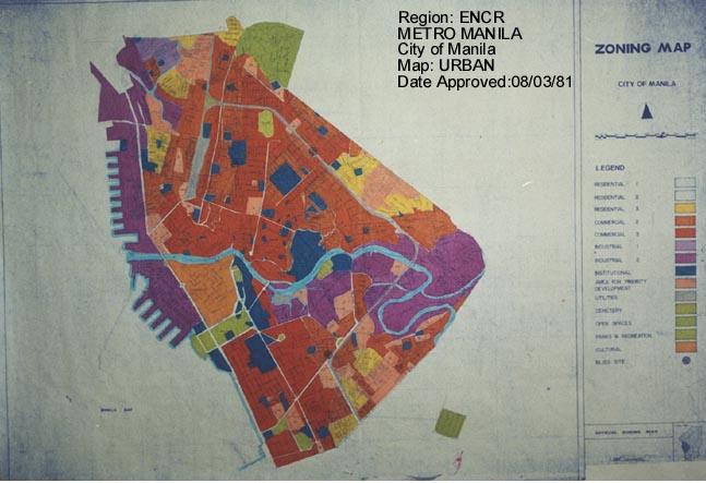
I was browsing the HLURB web site and found jpegs of land use maps from the metro area. I wish they had a land use map of the whole metro. All the land use maps are dated 1981 - does that mean that none of the MM cities have undertaken a comprehensive land use mapping/zoning since then? The website says there is a GIS cookbook for LGU projects going on - as part of a preparation for comprehensive land use submissions by the cities. It seems like its a two year project that started in 2004 - so we'll probably have new land use plans in 2006.
Given the precedent, the new land use plans will be in force for the next 30 years. They will decide the shape of Metro Manila for the next 100.
What is telling is that the CLUPs are being done on a city/municipality basis. Will there be a regional plan?
More on this later.


3 comments:
Hey, fantatsic site - I found you through my old freind Carlos Celdran's site Walk this Way!
Although I am not Pinoy, I've spent many years living in the Philippines, and am greatly interested in many of the issues you post about - especially heritage/historical preservation. I am also based in DC now.
I haven't been posting much about the Philippines - my site is decidedly non-political and there is great deal to comment on these days (I'll leave that to the experts!) -actually, i've been remiss in posting at all recently.
anyways, i'll bookmark your site and add a link!
Fantastic work!
hi urbano,
the following cities have clups:
Pasig, Las Pinas, Paranaque, Makati, Marikina, Muntinlupa and Mandaluyong
hi jean,
thanks for the tip. my contacts back home tell me the CLUPs are undergoing final approval. no word if there is a requirement for regional concurence.
I hope they somehow put the plans/maps online.
Post a Comment