7.27.2005

the long view


"cities go through tremendous change...but they endure" -Stewart Brand


May I recommend a set of very stimulating lectures about long term thinking sponsored by the Long Now Foundation. You can download mp3 files of most of the lectures here.

You can start with any lecture, but for city-philes I would suggest Stewart Brand's lecture on Cities and Time. The lecture is 1 hour 17 minutes long, so make sure you have a long enough moment to enjoy it.

Stewart Brand is one of my all time favorite thinkers and was greatly influenced by his book Clock of the Long Now. His discussion in the lecture (and in the book) on the pace of change cycles (pictured above) makes me think that the struggles of my home country is about changing culture and governance (not governments) -an exercise that we have been struggling with over the last 200 years. The paroxysms of the present are symptoms of the change taking place and the deeper layers.

thanks for the shout out


Carlos Celdran, famous Manila "streetwalker" posted a shout out and a link from his well-read site to mine. Thanks!

(If you haven't taken his tour, I am told it is a MUST.)

Like I said, we need more Carlos Celdrans in the city. Help us to appreciate home ground just a bit more.

On another note, I really need to expand my list of city oriented pinoy sites.

changing the image


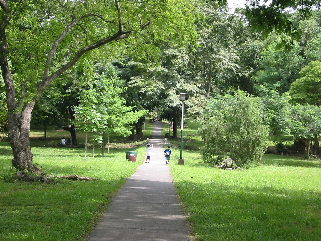
My friend Juned, who runs several blogs has one called Pinoy Snapshots where he puts up his own great pictures of random places in Metro Manila. He's got a few great panoramic views.

Two didactic points (of course there has to be a "moral lesson") I get from his pictures:

The one above reminds us of how few green open spaces we have left in Metro Manila. Green and open spaces are democratic spaces. They provide places for play and relaxation for the masa. (Just visit the Quezon Memorial Circle on any Saturday and you'll know what I mean.) A rational, people-centric planning process would ensure that we retain open spaces for the city. (Check out Bogota's experience.)

The second is that re-imagining our city means re-imaging it. The mental picture we all have (born by pictures in local and foreign media) is of Smokey Mountain or Payatas. Very few media "establishing shots" show the city's skyline. This is something that the DOT or the Philippine Information Agency should undertake. I know images of beautiful islands are geared toward tourist sales -but juxtaposing it next to the modernity of our cities (at least part of it) will add to civic pride.

Maybe Philippine media can begin considering this as some sort of low-intensity advocacy?

7.25.2005

planning departments


I surfed through several city websites of the constituent cities of Metro Manila to look for any postings about their planning departments. Most of them just listed the department but had little other info. The following had some kind of links to a planning or zoning department:


Only Mandaluyong listed an officer (with an email address) and only Muntilupa listed some sort of process or mission/vision for planning that committed to involving "stockholders." (I suppose they meant stakeholders.)

None talked about comprehensive plans or planning process. None had links to zoning maps.

7.22.2005

monumental


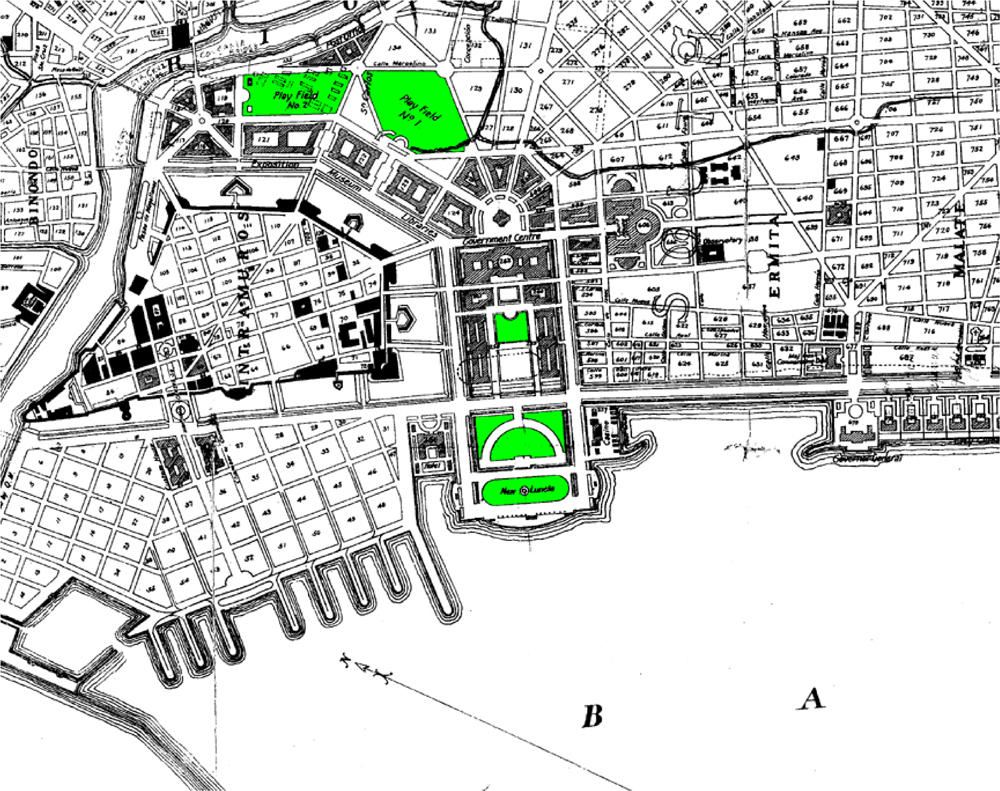
Here's detail from Burnham's plan. (Colors have been altered, of course.)

You can clearly see the the diagonal boulevards and the grid. Also, the present Rizal Park was supposed to be a government center -with monumental buildings arranged in a half-arc facing the bay. The Executive Building (previously occupied by the Senate and now by the National Museum*) and the Finance Building were the only ones that got built. I think the Commonwealth Government set aside money for the project (saved over a decade) but then decided to spend it on rural irrigation projects instead.

The boulevards all terminated at the center of the arc of buildings - one road had a direct connection to the railroad station in Paco.

Notice also how the new government center butted-up right next to the walls of Intramuros -giving it an active edge. Currently, the Walls have open fields/parks/driving ranges as foreground -with no active edge connecting the old city to the new city.

(*isn't it sad that the National Museum doesn't seem to have it's own domain and seems to just be squatting on Tripod?)

burnham's manila


[note: minor change -the linked picture is now bigger]

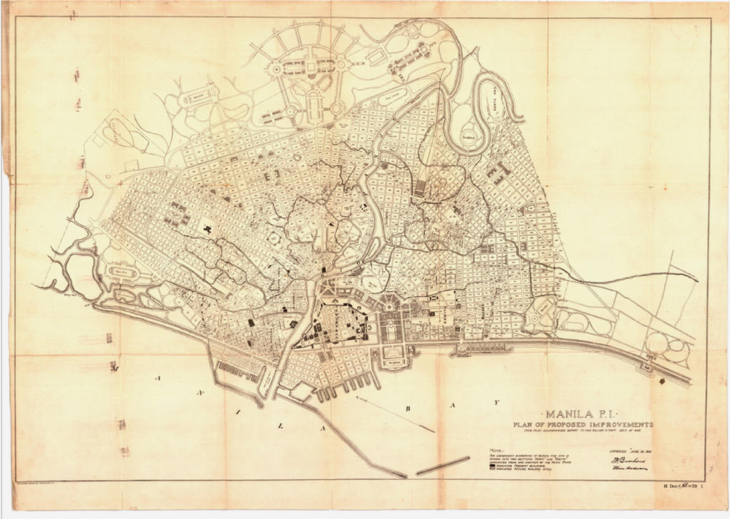
Here's a treat for you manilaphiles and history buffs. An image of Daniel Burnham's 1905 plan for Manila. (I'll put a close-in detail picture in the next entry.) Burham was commissioned to create a masterplan for Manila (by then Governor General William Howard Taft if I'm not mistaken) in 1901 and he completed the commission in 1905.

So Burnham actually practiced on Manila before he tackled Chicago, San Francisco or DC. (Chicago pinoys i've met swear that Lakeshore Drive feels like Roxas Boulevard --well, now you know why.)

Notice the formal grid with the diagonal boulevards -which mark the City Beautiful Movement. DC denizens will recognize this pattern.

Parts of this plan were enacted (like Dewey/Roxas Boulevard and the Executive and Finance Buildings along with Manila City Hall) but the project was dropped post WWII. I know "what might have beens" are usually a waste of time, but imagine where we would be if we had followed the masterplan. (Chicago is still actually implementing parts of Burnham's Plan to this day.)

I've been visiting Carlos Celdran's and IvanM's sites lately. Both gentlemen offer very entertaining and educational historic walking tours of Manila. (I have friends who've taken the tour and think the world of them.) I think the work they do is invaluable in having our citizens re-frame how they view our home city.

Having a sense of the past can inspire us to re-imagine the future.

7.21.2005

land use


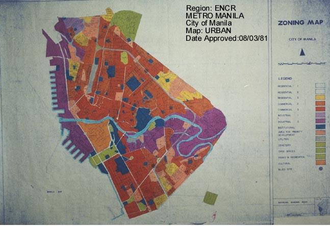
I was browsing the HLURB web site and found jpegs of land use maps from the metro area. I wish they had a land use map of the whole metro. All the land use maps are dated 1981 - does that mean that none of the MM cities have undertaken a comprehensive land use mapping/zoning since then? The website says there is a GIS cookbook for LGU projects going on - as part of a preparation for comprehensive land use submissions by the cities. It seems like its a two year project that started in 2004 - so we'll probably have new land use plans in 2006.

Given the precedent, the new land use plans will be in force for the next 30 years. They will decide the shape of Metro Manila for the next 100.

What is telling is that the CLUPs are being done on a city/municipality basis. Will there be a regional plan?

More on this later.

7.20.2005

lord of all you survey


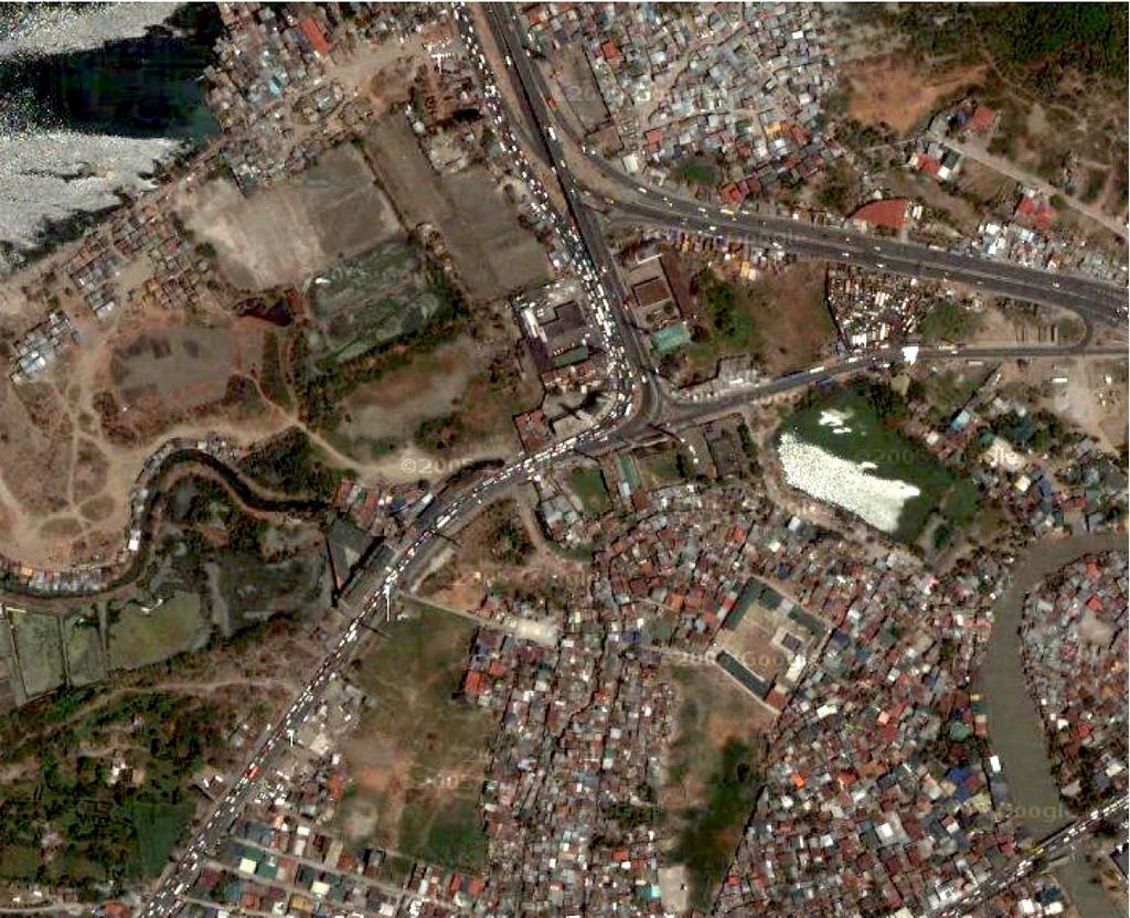
Check out hi-resolution aerials of Cavite on google maps. As far as I can tell, only northern Cavite (south Manila Bay shore) and the Clark and Pampanga area seem to have images at this resolution.

The Cavite image i linked to above clearly shows the interchange at the end of Coastal Road - and you can see how bad the traffic is. Zooming up to a higher altitude, you can see the extent of the spread of the urbanized areas in the national capital region.

I hope more data becomes available, and that google puts this up on google maps. The more we understand our spatial environment, the more we can better plan our growth.

7.19.2005

living machine


The World Bank is spending $ 64M to upgrade Metro Manila's sewers. I wish there was a citizen's voice or a green group that would find a place on the table.

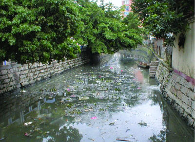
The picture above is from Baima, China. It's a living machine -a constructed wetland that cleans an urban creek. Can you imagine something like this on the Pasig River, the Marikina River or on Tripa de Galina?

"In Baima, China, a series of canals (top) used to collect and channel sewage, commercial wastewater, and stormwater runoff threatened the health of the city's 6 million inhabitants. After just two months, a Restorer system supporting 12,000 plants of 20 native species (bottom) is reducing odors, eliminating solids, improving water clarity, and reducing bacteria in the effluent that flows to the area's major river."

image credits: Ocean Arks International


(more about this project after the link)

long hiatus


I haven't posted anything for over a month. Given the political turmoil in the country, I found it not prudent to discuss metropolitan issues. The nation's attention and energies are taken up by the "Hello Garci" scandal.

The upside to all of this, as I told a few friends of mine, is that it is getting harder and harder for any sitting president to be tainted with corruption. FVR barely escaped with Amari/PEA (an issue with urban planning implications, by the way); Erap was out in 2.5 years -and GMA lasted barely a year before the corruption charges came to fore.

The next chief executive (prime minister or president) will have to either be extremely subtle and extremely smart to be able to hide corruption or they will have to seriously be squeaky clean.

Having said that though, there are a number of issues that are coming down the pipe that are of serious consequences:

Metro Manila's shift to CNG buses
The third Metro Manila Sewerage project
The future sale of Camp Aguinaldo and Camp Crame

All of these have serious, long term implications on the growth and quality of life in Metro Manila.

Quick Links

Notable posts on the metro