7.06.2006

going mental (3) -a river runs through it
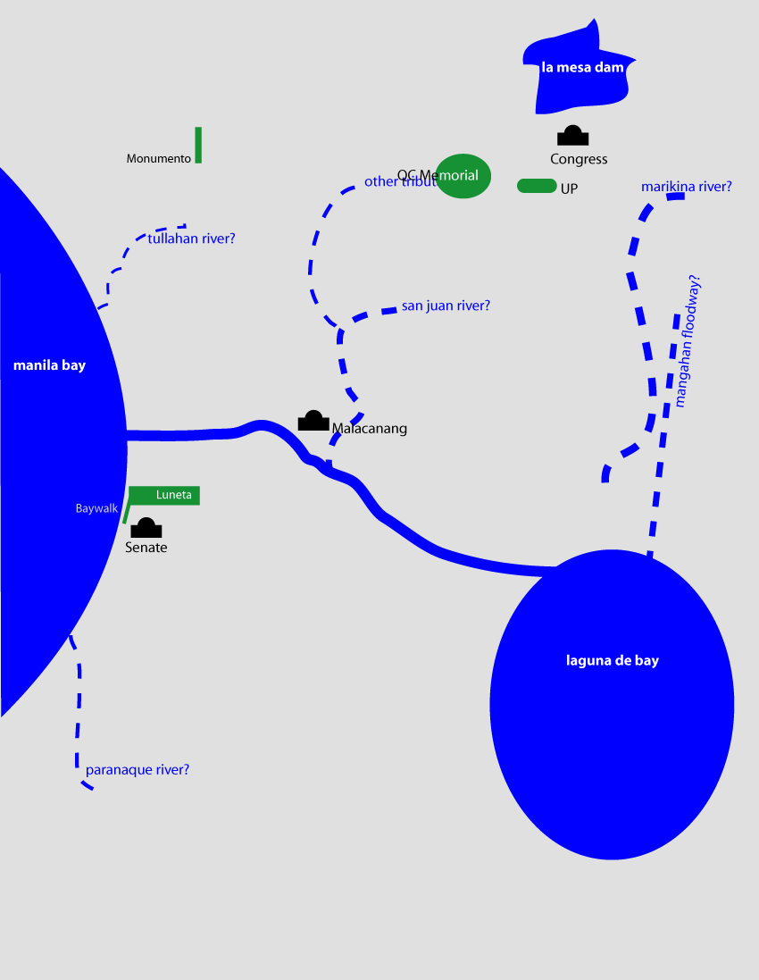
Maynila was born on the banks of the Pasig -established by people who were taga-ilog ("river folk") and yet 600 years later, we are so disconnected from our bodies of water.

Notice my conceptual map - I know the Pasig connects the Bay to the Lake and I know it runs north of Makati and South of QC, San Juan and Mandaluyong - but I am, as I suppose the majority of us are, not aware of its eastward route. I have no mental image of how it meets the Laguna de Bay.

I have no mental image of the shores of the lake. I have a memory of driving around the lake -but not at the water's edge.

I know the San Juan River and Marikina River feed into the Pasig -but also have no mental image of where these rivers meet. I know the Manggahan floodway separates from the Marikina River at the Napindan Floodgates -and the floodway then runs straight towards the bay. I also know that the Tullahan feeds into the Bay and somewhere down south, the Paranaque River also feeds the Bay.

Why am I not aware of the paths of these rivers? Mainly because so few landmarks and public spaces are on the waterfront. Baywalk and the reclamation area face the bay. The Senate, the Cultural Center, the Folk Arts Theatre and the Coconut Palace are on the waterfront. So too the Quirino Grandstand in Rizal Park. The Malacanang is on the Pasig. The Jones, Macarthur, Quezon and the Ayala bridge over the river near Quiapo and Escolta.

Apart from that, very little of our urban life is connected to the water. So the rivers are dead -not just biologically, but also in our imaginations. The rivers do make their presences felt when they overflow their banks.

There are efforts to revive the Pasig and the return of the ferry will help -but until we reclaim the waterfront as public space, our waterbodies will live outside our conception of our metropolis.


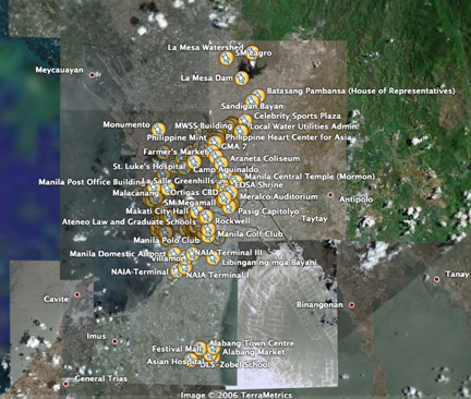
(You can download a kmz file of the metro's major rivers on Google Earth Philippines or you can view it on Google Maps.)

7.05.2006

going mental (2)

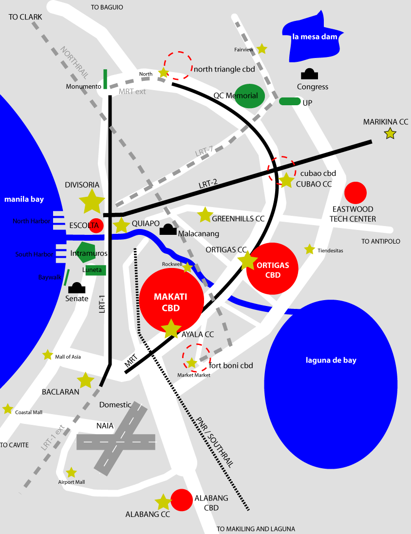
Let's start with this. A conceptual map of Metro Manila. I've marked out the existing and potential business districts. Also the commercial centers. I've also put in the existing and proposed mass transit lines.

The symbology should be easy enough to understand.

It is by no means exhaustive (conceptual nga no!) but I will use it a starting point for discussing connectivity -paths and nodes within the metropolis.

Over the next few posts I will examine what is connected and what is not and what should be.

(Visit my latest post at Philippines Makeover to see some connections I'd like to make.)

(Email me if you want the illustrator file of the conceptual map.)

7.01.2006

going mental

They say if you want to understand something - you have to look at that something from a distance. That's why I am so excited about the high res images of Metro Manila and our other city centers in Google Earth. It's not so much the joy of virtual roof surfing but the chance to assemble a better mental image of our city. It is, as Roby Alampay puts it, the chance to connect visualization to action.

I spent my elementary years in a public school, took high school in the premier state university where I also earned my college degree. As good as my education was, I do not ever remember having seen or discussed a map of Metro Manila or any of its component cities during my matriculation.

(The only time I got to take a long hard look at the built fabric of our metropolis was in grad school -as I researched more into the history of the city.)

Why is that? I remember long discussions about national issues - history, sociology, culture -but I never once saw a map of the places I lived in.

I did not have a clear mental picture of the city which, for better or for worse, circumscribed my daily life.

I could navigate it pretty well. I lived in northern QC and worked in Makati and I could easily take the New Panaderos shortcut and cut through Don Antonio to shave 30 to 40 minutes off my daily commute. I could find a path from Intramuros to Reina Regente and Divisoria and then take a northbound route to Monumento. I could take airport road and go through the villages to get to Alabang - so I (as well as the rest of us) had a mental map of the nodes and paths and edges of the metropolis. I did not have a whole picture.

It may seem trivial -this lack of a whole picture - but it points to what Kevin Lynch calls the "imageability" of the city. I saw Metro Manila, as I suspect the general population does, only as disjointed nodes connected by circuitous paths.

Google Earth affords all of us a bird's eye-view - a more complete map of the city, and maps help us see not only distance -paths and nodes and edges -but also relationships and scale. Maps help us to see density -and open space. Maps help us to see layers of history, and economic segration and spatial inequalities. Maps helps us to see the whole picture.

There is a subversive element in seeing the whole picture. It leads us to ask why?

More importantly, it prompts us to ask "Why not?"

6.27.2006

mind the gap: understanding urbanization 2

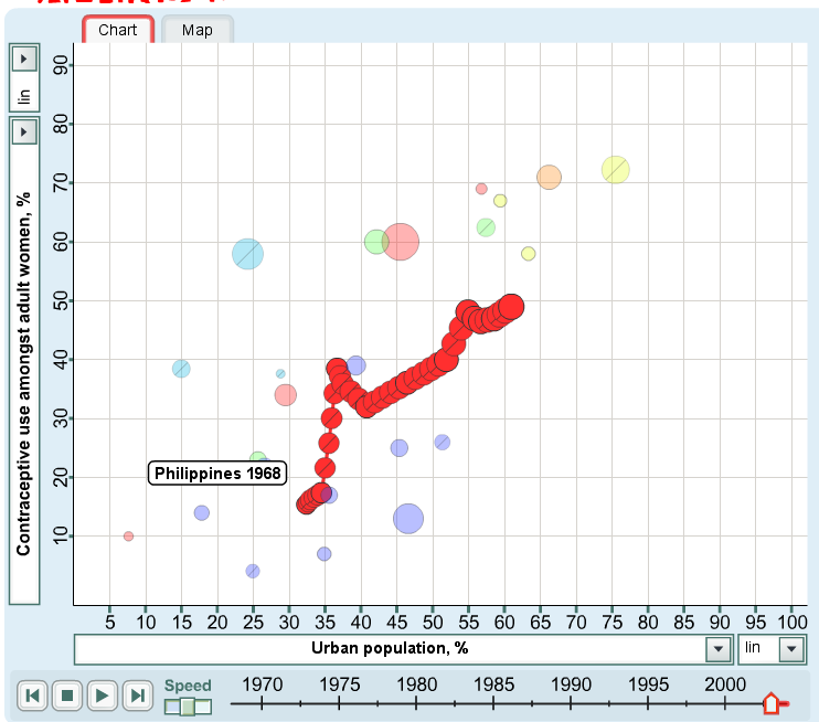
gapminder time series: fertility vs. use of contraceptives (phils. 1965-2005)

gapminder time series: fertility vs. urbanization (phils. 1965-2005)


If you haven't visited Gapminder -and toyed around with the data, your missing a big part of understanding the world we live in. (Find out more about it through Dr. Hans Rosling's lecture at TED Talks.)

It is an unbelievably great resource and a great way to understand the dynamics of the world. The two charts above for instance show the relationship between fertility (number of children per woman) and level of urbanization (percent of the population that lives in urban areas) vs. the former against the use of contraceptives.

It shows there is a stronger relationship between increasing urbanization and lower fertility rates -even more so than fertility vs. the use of contraceptives. (Although it is clear that urbanization also increases the use of contraceptives among women.)

6.22.2006

just what we needed


The new high res sat images of Metro Manila on Google Earth has made us crazy. Roby Alampay and I have decided that we need a central repository for all Google Earth data on the Philippines. He's set up a wiki called GoogleEarthPhilippines and uploaded a few kmz files to mark up your Google Earth.

So far we've got all the MRT/LRT stations, a partial of MM landmarks, a partial of UP Diliman (someone put in the dorms please), a partial of schools, etc.

We can't do this on our own so we're inviting everyone to come and upload your own kmz files. Visit the wiki here leave some comments or send us a wishlist of what you want to see marked.

6.20.2006

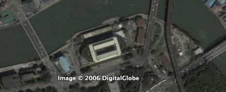
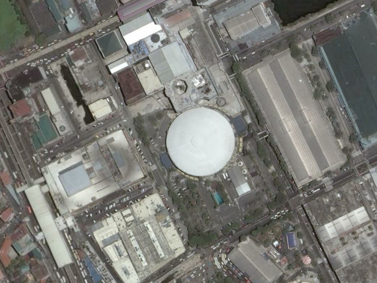
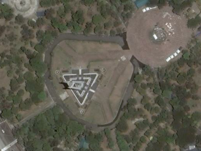
fun with google earth: 3


Location A


Location B


Location C


Location D

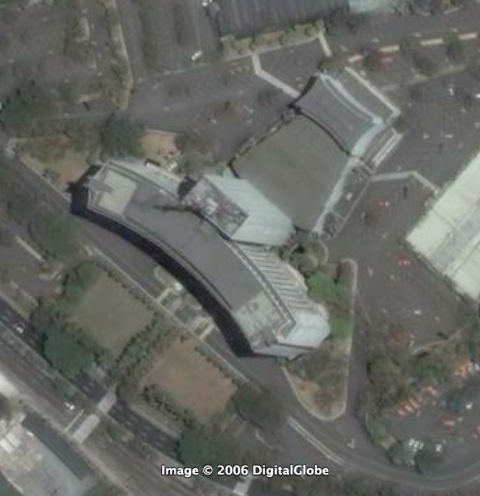
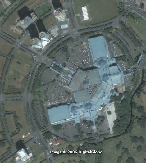
So let's do a slightly harder set. Four locations -wider ranging. All still major landmarks.

Click on the pictures for larger versions.

fun with google earth: 2

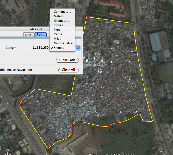
Click for larger image.

This got me ROTFL. Check out the image above for the units of measurement available on Google Earth.

I believe he's still very much around.

(p.s. -the outlined area is the informal settlers community in the North Triangle of Q.C.)

Great Metro Manila Makeover


You like google earth? Any good at photoshop? Have ideas?

Check out Roby's new blog: Metro Manila Makeover.

6.19.2006

fun with google earth

Location A

Location B


Location C

So I've been having great fun with the high res sat imagery of Metro Manila from the latest version of Google Earth.

I've clipped out three spots (Locations A, B and C) - can you guess what they are?


6.17.2006

city slickers


BBC asks you to take a quiz to see if you are a country bumpkin, a commuter or a city slicker.

The Bruce Lee statue was a surprise.

Quick Links

Notable posts on the metro