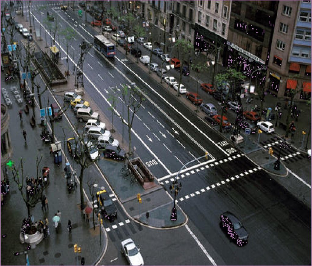
2.15.2006

best of the city
people's choice


I've been sitting on these results for a little too long now. Finally, here they are: your choices for the best urban places in the city.

(Voters were allowed multiple choices so the percentages will not tally.)

Best Street: Adriatico in Malate (42.9% of votes)
Runners up: Binondo/Ongpin St. (30.8%) and Roxas Boulevard (14.3%)

Best District: Makati CBD (50%)
Runners up: Binondo/Ongpin St. (30.8%) and Quiapo (14.3%)

Best Open Space, Park or Plaza: Greenbelt Park (37.5%)
Runners up: Intramuros Walls, American Cemetery and UP Sunken Garden (all tied at 28.5%)

Best Market or Mall: Greenbelt Mall (61.5%)
Runner up: Tiendesitas (23.1%)

Best Temporary or Day Market: Salcedo and Legaspi Weekend Markets (63.6%)

Best Campus: UP Diliman (64.3%)
Runner up: CCP Complex (50%)

Best Building: San Agustin Church (42.9%)
Runner up: Ayala Museum (28.6%)

Let's do this again next year!

2.03.2006

green infrastructure
rethinking our streets (3)
updated with numbers


Image credit: A new community redevelopment project in Seattle includes a natural drainage system.
From Stormwater (The Journal for Surface Water Professionals).
The only time we realize that our streets are actually part of a larger-scale ecosystem is during a heavy downpour when storm water decides to use our streets as temporary rivers.

Engineers deal with storm water the same way they deal with any input-output problem. The equation is simple: to cope with the incoming volume, increase the throughput so that you get maximum output. That is the dogma -and that's how we've been dealing with floodwaters on our streets ever since: Move it out as fast as possible to the nearest body of water. Big storms require big drains and a bigger the flood control system. (Some of our widest roads have five meter diameter pipes as stormwater drains.)

(The biggest example of this thinking in Metro Manila is the Manggahan Floodway which channelized portions of a river and then built a long canal to drain the low lying parts of the eastern metropolis into the Laguna Lake.)

The drain-the-waters-as-fast-as-you-can approach, works, to a certain point. It fails if: 1) the input volume is bigger than what you designed the system for; or 2) if the throughput gets clogged.

The throughput does get clogged. Often. Which requires a lot of maintenance, a lot of keeping the channels clean -of building even bigger pipes to drain the water. And every year, we get the same complaint: trash clogs the drainways. At the same time, we've been paving over more and more of our land area causing more water to run off into our streets and overwhelming our flood control systems.

Year after year, the floods get worse (especially the flash floods on EDSA and the Buendia-SLEX intersection) and year after year, the proposed solution is the same: more maintenance, or proposals for bigger flood control projects.

Time for a rethink.

Natural systems approach water differently. Nature prefers to slow down the water, allowing it to pool around tree roots, slowing the flow with grass, collecting it in seasonal ponds and generally letting it percolate into the soil. This has two effects: 1) it reduces surface water runoff so the creeks and waterways don't get overwhelmed and 2) it preserves precious topsoil, keeping it from getting washed away.

Engineers have realized that the environmentalists do have something to say and have made the connection that speeding up water is ineffectual and damaging to the environment. (You can draw a straight line cause and effect from the flood control projects in the Mississippi river basin to the tragedy of New Orleans.)

They have also begun to rethink how to handle water runoff on streets and roadways. Yes, you want to drain the roadway, but it doesn't mean channeling the water out to the nearest body of water. It is better to hold and percolate -not shunt it out but allowing it to recharge the groundwater aquifers. (And yes, our aquifers do need recharging. See this pdf report -2.6mb).

So, landscaping -which was used primarily as ornamentation (and apparently still is) is now seen as an approach to handling water-runoff. Instead of trying to drain the rainwater off into pipes, landscape systems (like shared tree wells, permeable pavements and bioswales) hold the water locally and drain it into the soil rather than draining it into a flood system. The landscape becomes a natural flood control system. (Guess what, it also reduces water pollution -by eliminating nonpoint source pollution and by using the soil to filter the water before it gets to the aquifers.)

So the clean-and-green proponents and the save-the-pasig movement need to sit down with our traffic and the flood control engineers to re-think the way our streets deal with water.

Well designed streets, which reconceptualize the network of roads as green infrastructure -so that it not only carries vehicular traffic but also protects the environment, will do more than just provide us with grassy medians, sidewalk trees or flower beds. Well designed streets will probably save our cities and revive our dying rivers and lakes.


NEW! UPDATED! NOW WITH NUMBERS!

A conversation with a friend led me to running some number scenarios of what the stormwater runoff volume for Metro Manila might look like, and though the math is rudimentary, the numbers are startling:

If you assume that 30% our megacity's land area (636 sq.km.) is devoted to pavement (roadways) and 5% devoted to waterways (very generous assumption), then you would get:
  • 191 sq.km of roads
  • 32 sq. km. of waterways
If a storm dumps water at the volume of 10cm per hour (that's about 4 inches of rain -not so spectacular for the metro), the 191 sq.km of roadways would produce a runoff volume in the order of 190.8M cubic meters. (And we're only looking at the roadway runoff -and naively assuming that nothing else (parking lots, driveways, etc.) drains into the roadways.

Assume, again rather generously, that your 32 sq.km. of waterways has an average depth of 2 meters -then the total carrying capacity of the waterways would be 63.6M cubic meters -or roughly just 1/3 of the runoff our roadway will produce. (And we're assuming that the throughput is at 100% -no trash or blockages.)

That means our waterways will have to drain completely every 20 minutes if it is to absorb and remove just 1 hour of (10cm) of stormwater runoff from our streets!

If only 50% of our streets (paved areas) had some natural drainage/bio retention system -of say 1M depth holding capacity for every square meter of street, we could absorb half of that runoff (95.4M) locally. No need to wait for the waterways to drain.

1.31.2006

white is the new pink?
(to catch all that yellow)


We-make-money-not-art recently featured the pee-tree:

"So Joa Herrenknecht has designed the Pee-tree urinal for public spaces. His bright ceramic white colour is a strong signal that can be seen from far – making it accessible when in urgent need. The trunk offers a perfect place for messaging, e.g. "I was here" or "done that" statements. The urine is directly flushed down to the underground sewage canal.

You think we can convince BF to replace his pink urinals with these?

Original and more examples from the pee-pee project.

heritage, home improvement
and rent control


Image credit: Bahay na Bato in San Nicolas from Tom Cockrem's Travel Image Library.
"In many cases rent control appears to be the most efficient technique presently known to destroy a city—except for bombing."
Assar Lindbeck

If there is a third rail in Philippine politics, it is rent control. The law has been extended countless times (the latest incarnation is RA 9341 which extends RA 9161) and though each time the law is passed or extended and sunset date is set, it is nevertheless predictable that it will be extended or renewed next time the law is set to lapse.

Arroyo, who has a Ph.D. in economics, must KNOW about the damaging effects of rent control and so I DO NOT UNDERSTAND why she approved the current extension. Or why anyone who took some basic economics in college (i.e. -our lawmakers and policy wonks) would approve of it. -Apart from it being POLITICALLY UNTOUCHABLE.

I am by no means neo-liberal in my economics but the left and right sides of the spectrum of economic thinking (from the chicago school/washington consensus to socialists and the welfare state architects of northern europe) agree on the destructive effects of rent control. It distorts not only the market but damages the built environment itself:
"...rent control diverts new investment, which would otherwise have gone to rental housing, toward other, greener pastures—greener in terms of consumer need. They have demonstrated that it leads to housing deterioration, to fewer repairs and less maintenance. For example, Paul Niebanck reports that 29 percent of rent-controlled housing in the United States is deteriorated, but only 8 percent of the uncontrolled units are in such a state of disrepair. Joel Brenner and Herbert Franklin cite similar statistics for England and France." (Walter Block, 1990)
Assar Lindbeck, whom I quote above, is a socialist. Paul Krugman has this to say:
"The analysis of rent control is among the best-understood issues in all of economics, and -- among economists, anyway -- one of the least controversial. In 1992 a poll of the American Economic Association found 93 percent of its members agreeing that "a ceiling on rents reduces the quality and quantity of housing." Almost every freshman-level textbook contains a case study on rent control, using its known adverse side effects to illustrate the principles of supply and demand."
And yet it continues to be untouchable -even by our columnists and pundits. (It could be that my google-foo is weak, but I can't find a single comment by Winnie Monsod on the matter, Raul Pangalangan condemns it but only in passing while criticizing tuition controls. Not even the ultra-conservative Bernie Villegas has critiqued it.)

It's not for a lack of local studies, either. A 2002 study by Marife Ballesteros for the Philippine Institute for Developmental Studies showed that:
"net benefits from rent control are positive and targets mainly the poor families. However, benefits have negligible effects on income. They also tend to be eroded by the regressive effects of rent control on supply of rental housing, in particular, the strict eviction provisions of the law. Stiff competition for low-priced rental housing, low quality of housing for the poor, higher rents for the uncontrolled sector, and misallocation of resources are the possible effects of rent control on housing."
Now why should this be important to the Heritage Conservation Society? Because the only real way to preserve our built environment is to make sure it is in the economic interest of the owners to invest in their properties. The Society may save a building or two by their current media strategy but they will do an even greater service to Metro Manila's heritage by making sure it is financially rewarding for landowners to reinvest in old buildings. Otherwise, the lack of actual income from rent causes disinvestment and decay. Landowners who can source new capital will more likely tear down their old buildings, while those who do not have the resources will not even be able to re-finance enough so that they can invest in the upkeep of their old buildings.

Want to know why Metro Manila is in a state of disrepair? Five decades of rent control. Want to know why we have squatter colonies? Rent control. Want to know why we're losing beautiful old homes? Rent control. Want to know why we have a small middle class? Rent control.

Now what about the poor? Won't lifting rent control make it more difficult for the majority of our population to find housing? We've had rent control for over 5 decades. As Dr. Phil likes to ask, "How's that working for you?"

Multiple Choice Quiz: We add over 100,000 people to the population of Metro Manila each year. And because we build so few new apartments, where do you think most of our new internal migrants wind up living?
  • a) In dilapidated housing
  • b) In crumbling apartment blocks
  • c) In old, over crowded boarding rooms
  • d) In squatter colonies
  • e) All of the above

1.21.2006

measure for measure
rethinking our streets (2)


"The common thread in the new approach to traffic engineering is a recognition that the way you build a road affects far more than the movement of vehicles. It determines how drivers behave on it, whether pedestrians feel safe to walk alongside it, what kinds of businesses and housing spring up along it." WIRED 12.12


If there is one piece of unsolicited advice that I would like BF and the other Metro Manila mayors to hear, it is this:

If you want to improve quality of life in the city,
change the qualitative measure you use
for measuring road performance
.


It has become dogma among traffic engineers to measure road design by Level of Service (LOS). LOS has many factorials in the mix but essentially, on highways, LOS is measured at cars per second per mile highway. So the more cars pass at faster speeds, the higher the level of service. On city roads, the LOS is measured along intersections and is calculated as seconds delay per vehicle. So the longer a car is delayed at an intersection, the lower the LOS of that intersection.

Makes sense, if your main interest is keeping the traffic flowing. You can see that logic in play with the MMDA's u-turn slots. The intention of the closing the intersections is to make the road a clear way -thereby reducing seconds of delay, thereby improving the LOS.

So what's missing from the picture? Again, it goes back to thinking of streets only as roadways. It does not account for:

  1. volume of people moved

  2. road safety

  3. effect on commerce along the street

Why are these important?

Move people not vehicles

Counting vehicles instead of people means the bus that carries 50-75 people is equal in count to one person driving a car. Try comparing how much road space a bus with 75 people takes up, vs. 75 cars each with a driver. If you want to increase road efficiency, then you go to the more important factor of counting how many people you can actually get from one place to another.

Faster roads are less safe and less efficient

Increasing vehicle speeds increases the likelihood of accidents. It also makes the road more dangerous for pedestrians and bikers. Plus, it requires you to separate pedestrian traffic by raising the crosswalk.

It is not speed per se that bothers drivers, it is the unpredictability of traffic flow. Slower speeds but smoother flowing traffic is actually preferable to high speed, variable delays roadways.

Road capacity also suffers at higher speeds -faster traffic takes up more space per car than slower trafic. (Read more about the impact of road diets.)

One approach is to look at average vehicle speed and the standard deviation from the speed - then working on reducing the standard deviation, not increasing the speed. Reducing the deviation means smoothing out the traffic.

Commerce dies next to fast streets

Because fast streets feel less safe for pedestrians, commerce at street level dies. It is no accident (no pun intended) that retail flourishes on the slowest intersection of Quezon Avenue. The rest of the avenue (which was designed as a boulevard and has fabulously wide sidewalks) is devoted to seedy nightlife KTV bars that are dead in the daytime.

I know QC is in excellent fiscal health, but imagine how much more they could earn in sales taxes if Quezon Ave. was an active retail destination?

So, to reiterate: If the mayors to improve the city, they must change the qualitative measure they use for measuring road performance.

There are other, newer ways to measure LOS. The Victoria Transport Institute (Canada) publishes several studies on transportation costs and traffic management. There's an excellent one on traffic access and mobility (pdf).

The MM mayors and BF recently visited Vancouver to study the city's best practices on waste management. I can only hope they had the time to study Vancouver's traffic management plan and see how good street design will serve both vehicles and pedestrians and improve the quality of life in our cities.

(I'll be continuing my series on rethinking our streets -but next up: why the Heritage Conservation Society should be fighting rent control.)

1.18.2006

streets not roads:
rethinking our streets (1)


We remember cities mostly by their streets. A high street or a major commerce corridor imparts to us our lasting impressions of a city. So there is Las Ramblas in Barcelona, Picadilly Circus in London, Times Square in New York, Tsim Sha Tsui in Hongkong.

Streets are the largest publicly owned spaces in any city and also take up the majority of land use. Typically 30-35% of a city's land area is devoted to streets.

Streets are the lifeblood of any city and convey commerce and people from home to office to factory. Streets are also the infrastructure web that defines a city -that connects districts and functions and serves as wayfinding. More than buildings or monuments, streets carry what Kevin Lynch calls the image of the city.

Streets, like cities, also persist. Unless interrupted by war or catastrophe or bad urban planning, a city will retain the fabric of its streets through the centuries. Rome has kept its fabric -so has Jericho and Jerusalem -so has Istanbul and Cairo.

Streets that serve cities well serve many functions -and conveying car traffic is just one of them. Streets move people -on foot, on bikes, in cars, in buses. Streets provide public storage for private goods (parking). Streets are exchanges -where people can meet, sell goods, explore the city. Streets are environmental channels - generating pollution or moving rain and stormwater - or providing trees. Streets are free public event spaces for fairs, concerts of mass demonstrations.

Which is why it concerns me that the MMDA, as part of its home city improvement bent, is undertaking a road improvement program. (Starting with Commonwealth Ave. in Quezon City.) -I'm not sure whether it's 7 or 9 (older reports say 9) but here's the gist of what they want to do:

"MMDA's "Seven Major Roads" program, an integrated infrastructure development program focusing government resources in the improvement of seven major transport corridors, namely ; Commonwealth Ave., R10, C5, EDSA, Quezon Ave., and Marcos Highway.

Improvement of these seven major roads includes road widening, geometric improvements, sidewalk rehabilitation and various street furniture."

I'm not complaining about the effort -i'm complaining about the bias for roads vs. streets.

Roads are for cars. Streets are for people (including people in cars).

The logic of Metro Manila's streets has, for far too long, been dominated by auto-chauvinism. Motorized transport -particularly cars, are seen as the primary use of streets. Sidewalks have been sacrificed to the roadway (road widening) and then pedestrians are derided for spilling onto the road. Pedestrians are forced to accomodate cars - by corraling the sidewalk with fences and using overhead crosswalks instead of at-grade crossings.

This is not surprising seeing that the opinion leaders are probably all car owners/users. Also because our public transport system is built on motorized transport (and driven by weird logic of the boundary system).

If we are to recover our metropolis, if we are to make it livable, we must begin by reclaiming the lost functions of our street.

(more on this to follow)

the light at the end of the gridlock


Jay Walljasper, editor-at-large of Utne Magazine, in a recent article for the Michigan Land Use Institute, muses about the possibility of a world with fewer vehicles. What he says about the history of traffic in other cities gives me hope for our own woes about traffic and gridlock:

It’s helpful to remember that before there was Prague, with its fiercely reckless drivers, or Bangkok and Jakarta, with their horrendous traffic jams, the picture of a transportation nightmare in most people’s minds was Rome, Madrid, or London. In each of these places, autos represented something deeper than just a way to get around.

In Rome of the 1960s, car culture was a mark of Italy’s arrival as a prosperous nation; in Madrid of the 1970s, a badge of the modern consumer society that replaced Franco’s dictatorship; and in London of the 1980s, the supreme symbol of free-market freedom as defined by Margaret Thatcher.

But look at them now. London shocked the world in 2003 with the huge success of its congestion pricing policy, which charges drivers a hefty fee to enter a traffic-unsnarled city center.

Madrid tamed its famously unruly traffic with aggressive implementation of pedestrian streets and other measures to keep cars from ruining neighborhoods.

And Rome, the butt of so many jokes about impossible traffic and insane drivers, reduced traffic by 25 percent in its center — an initiative that has become the model for Paris, a city usually looked to as the urban ideal.

Which is a fitting intro for the succeeding series of posts where I want to begin a dialogue on how we can rethink our streets and in so doing rebuild our cities.

(BTW, don't forget to vote!)

1.16.2006

people's choice


Folks, its time to vote for the best urban places in Metro Manila.
Remember the qualifiers:


  • must be a publicly accessible place (i.e. - you don't have to pay to get in, or buy anything to get in)

  • preferably outdoor, or largely outdoor

  • democratic (not just for the burgis)

  • must contribute to making life in our metropolis just a little bit better

This link takes you to the survey.

Taking Sydney's cue, I've divided up the nominees into four categories: 1) Streets, Neighborhoods and Districts, 2) Parks and Plazas, 3) Malls and Markets (with a sub-category of temporary markets), and 4) Buildings and Campuses.

I've reproduced the list below, but please use the survey to register your votes. We're using the very scientific "audience applause" methodology so you can vote for as many places in each category as you please. (Polls close on January 31, 2006)


STREETS, NEIGHBORHOODS AND DISTRICTS

  • Adriatico Street (Malate)

  • Binondo

  • CCP Complex

  • Escolta

  • Evangelista Street (Quiapo)

  • Intramuros

  • Makati CBD (Salcedo and Legaspi Villages)

  • Malacanang

  • Malate

  • Ongpin Street.

  • Quiapo

  • Roxas Blvd.


MARKETS AND MALLS

  • Cartimar Market

  • Cubao X

  • Divisoria

  • Farmers Market (Cubao)

  • Gateway Mall (Cubao)

  • Glorietta

  • Greenbelt

  • Metrowalk (Pasig)

  • Tiendesitas


TEMPORARY MARKETS

  • Greenhills Weekend Market

  • Magallanes Weekend Market

  • Salcedo and Legaspi Weekend Markets


PARKS AND PLAZAS

  • American Cemetery

  • Arroceros Park

  • Baywalk

  • CCP Lawn

  • Chinese Cemetery

  • Crescent Circle (Fort Bonifacio)

  • Greenbelt Park

  • Intramuros Walls

  • Liwasang Bonifacio

  • Makati Parks and Gardens

  • Manila Zoo

  • Paco Park

  • Plaza Miranda

  • pocket park on Emerald Ave. (Ortigas)

  • Quezon Memorial Circle

  • Rizal Park

  • San Lorenzo Ruiz (Binondo)

  • Santa Cruz (Quiapo)

  • UP Lagoon

  • UP Sunken Garden


BUILDINGS AND CAMPUSES

  • Ayala Museum

  • CCP and the CCP Complex

  • FEU Campus

  • Las Pinas Church

  • Manila Cathedral

  • San Augustin Church

  • San Sebastian Church

  • UP Diliman Campus


Thanks to all the nice people who took the time to nominate their favorite places in the city.

1.14.2006

The Filipino, according to Google (updated)


Google Blogoscoped's Google Predjudice Map inspired me to do a similar search.

So what does the net (via Google) say about us? (468 links)

And what does it say about Manila? (133 links)

I should make a tag-cloud out of this...

UPDATE: I tried a search of "Filipinos are notorious for" and came up with this. Notice something though, most of the google links that come up are Filipino sites. What does that say about our self-image.

1.13.2006

A Global Look at Urban Planning

Image: Scott Dalton for The New York Times
Richard Burdett pedaling through Bogotá, Colombia, yesterday. He is visiting 18 cities that will be the subject of the architecture exhibition of the Venice Biennale this fall.
Copyright 2006 The New York Times Company

Yesterday's New York Times featured an article on Richard Burdett's upcoming exhibit on cities at the Venice Bienalle. Burdett is adviser to Ken Livingston (mayor of London). From the article:
"Is it possible to make new civic centers, new housing, which make people's lives hell?" he asked, speaking by telephone.

"The answer is yes," he answered. "Flip that around and ask, if that's the case, can you design squares, streets, buildings that can provide the possibility of a more integrated society?"

Mr. Burdett's topic, which five years ago might have been a gently heated discussion among colleagues, is now a global flashpoint. Cities are terrorist targets - New York, London, Madrid. Cities are the staging grounds for riots, Paris most recently. And cities everywhere are magnets for immigration, welcome or not. According to population projections, 75 percent of all people will live in a few dozen cities by 2030...

Mr. Burdett said that his exhibition and its conclusions will be political as well as architectural and the work of a planner.

"I don't think you can talk about issues that matter, in the design of cities, without talking about which political system delivers the better quality of life," he said. "Does democracy work? There are many models of civic intervention."

And in his travels to date, which system seems to be the winner?

"On the 6th of September, I will tell you," he said."

I'd like to have seen Metro Manila on Burdett's list but then we share the plight of Joburg, Caracas, Sao Paolo and the other megacities.

A description from the Vienna Bienalle site:
"The exhibition will tackle the key issues facing cities today: from migration and growth, to mobility and sustainable development. It will examine the role of architects and architecture in constructing democratic and sustainable urban environments, and their links to policymaking, governance and social cohesion. The exhibition will feature cities with a global reach, the majority with populations above five million people. It will paint a narrative of urban experiences from four continents across the globe, including Shanghai, Mumbai and Tokyo in Asia; Mexico City, São Paulo and New York in the Americas; Lagos and Johannesburg in Africa; Beirut and Istanbul in the Mediterranean arc; and European cities including London, Berlin and Moscow along with the urban regions of Catalonia, and Northern Italy (Milan, Turin, Genoa). In addition to this international panorama, the 2006 Venice Architecture Biennale will propose a manifesto for Cities of the 21st Century – focussing on the potential of cities to contribute to a more sustainable, democratic and equitable world."

Quick Links

Notable posts on the metro